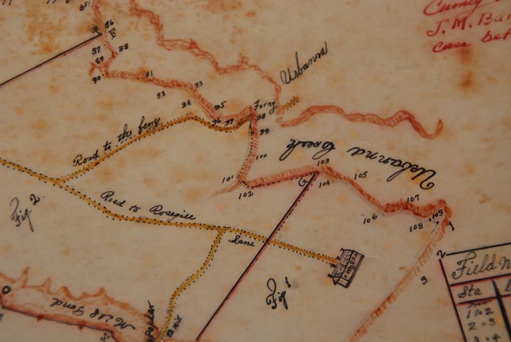
| Road to the Ferry |
We are not sure of the date of this, but Larry Chowning found it in the Middlesex County Courthouse. It's in a box of prints and surveys in the office of the clerk of the count. It's included on page 16 of Urbanna (Images of America) by Larry S. Chowning (July 2, 2012). On the date of the drawing, Larry says, "I'm not sure, but I'll check and see. It's a survey plat, I think drawn by Klondike Willie Stiff, which means its not ancient (1920s there about.) He was the county surveyor. When doing new surveys, he often drew diagrams of old survey plats to show how things used to be - often from older survey plats. I think this had something to do with road access across the millpond, but I'm not sure. I see J. M. in upper corner. Perhaps that was J. M. Barnhardt who owned the duck farm, which once was part of Rosegill." |
|
|
![]()